Wednesday, June 12, 2013

Grand Canyon - South Rim part II

After the Watchtower, we worked our way west along the South Rim until we got to the Grand Canyon Village, where we stayed for the night. We stopped off at several of the viewpoints along the way.


View of South Kaibab trail.


Sunset


Grand Canyon - South Rim part I

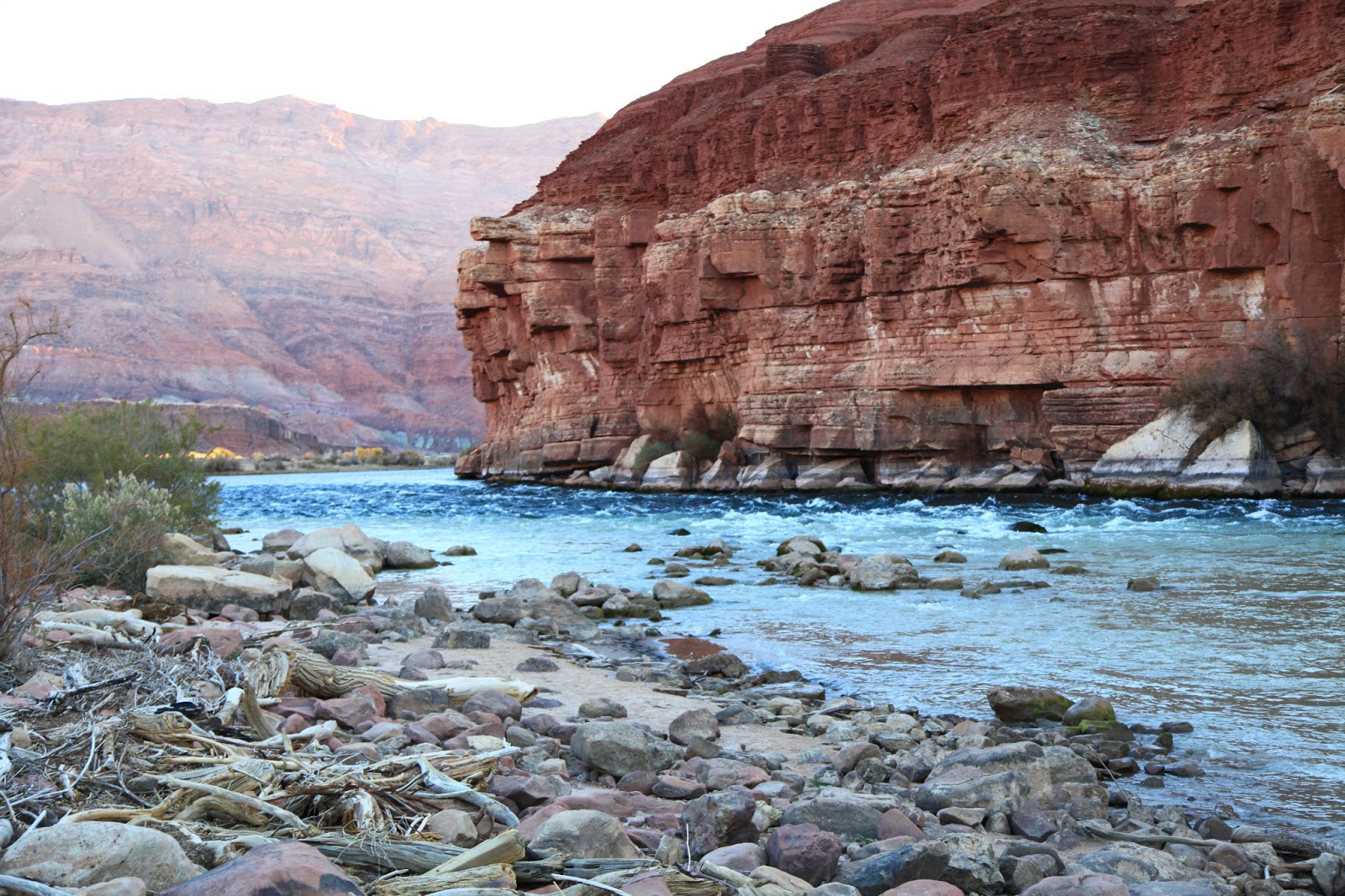
From Lees Ferry we headed back uphill, working our way around the east end of the canyon, through Navajo land and then back west towards the South Rim. On the way in to the park you pass over the Little Colorado River, which has its own decent looking gorge that it has carved for itself. At the east end of the Park is Desert Views.

The Watchtower at Desert Views is at 7,428 ft and gives views across the plains to the East and up the Grand Canyon to the North (it bends North here) and down to the West.


Black Mesa (looking East)

Looking North

Colorado River far below(flowing left to right into the canyon)

Looking West down the Grand Canyon

View from inside the Watchtower


After desert views we spotted a Mountain Lion which was crossing the road ahead of us. It walked into the bushes before I could pull out the camera, but I got a shot of it hiding in the bushes.

Zooming in you can make out its body and a bit of its face as it sits looking back at us through the scrub.

Tuesday, June 11, 2013

Lees Ferry/Marble Canyon

The Navajo Bridge at Marble Canyon crosses the Colorado, but if you take a side detour to Lees Ferry you find the launching place for most Grand Canyon rafting adventures downstream. (You can't go very far upstream because the Glen Canyon dam that creates Lake Powell is just up from this point). Lees Ferry is one of the only places you could historically easily access the Colorado River for miles around and so was a good place for a ferry since the mid 1800s.


Still waters, good for launching rafts


The Navajo Bridge - on the left is the 1929 bridge which you can now walk over, and the right is the current bridge. In the middle is the Sun!


The sections of the Vermillion Cliffs around this area had some pretty awesome rock formations too


There were lots of these tumbled down and then eroded rocks


This one gives a sense of the scale


Vermillion Cliffs

Driving from the North Rim to the South Rim of the Grand Canyon involved crossing the Colorado River at Marble Canyon near Lees Ferry - on the way you also pass by Vermillion Cliffs National Monument.

View of the cliffs in late afternoon as we wind our way down from the Kaibab Plateau


Our accommodations in the early morning light, with the cliffs rising up behind us


First sun hitting the tops of the cliffs.